
Dynamique spatio-temporelle de la forêt de mangrove dans la province de Trat en Thaïlande
DOI :
https://doi.org/10.19182/bft2022.353.a36999Mots-clés
province de Trat, diversité des espèces de mangroves en Thaïlande, algorithme de suivi automatique de la repousse, composites annuels Landsat, mangroves réhabilitées, moteur Google Earth, inventaires systématiques sur le terrain, influence des marées, restauration des écosystèmes, Thaïlande.Résumé
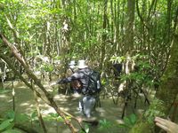
In the United Nations 2021–2030 ecosystem restoration programme, coastal ecosystems such as mangroves are listed as a priority for biodiversity restoration. Therefore, understanding mangrove species diversity and changes over time are essential to predict ecosystem health, viability and resilience to changing climatic and human pressures. However, when considering future conservation ambitions and policies for mangroves, it is also crucial to understand the effects of conservation interventions. To address these concerns, we needed to develop reliable inventory methods for mangrove forests, spatialised predictions of biodiversity and good practices for using Earth observation data. In this study, we investigated the gaps in knowledge concerning the spatial organisation, intertidal zones and the recent history of mangroves in Thailand's Trat province. We investigated the impacts on forest diversification of environmental parameters, such as topography, and of human interventions such as stand rehabilitation or plantations. We were able to integrate historical multi-satellite data, current ecological data and micro-topographic measurements to establish the status and describe the spatial organisation of the mangrove forests in the Province of Trat. Using the method described in this study, we were able to overcome the technical limitations of monitoring protocols and thus develop a powerful decision-support system to assess the recovery period of mangrove forests, their structural growth and the species composition of plantations and natural native stands over three decades. Our study also identifies the main influencing factors that compromise the quality of Earth observation data, and proposes specific best practices for monitoring mangrove ecosystems. In addition, we developed the ARMA tool (Automatic Regrowth Monitoring Algorithm) and summarized functional indicators (secondary succession) by type of stand. ARMA can identify the years of planting, recovery period, age and structural development of rehabilitated mangroves compared to adjacent natural and naturally regenerating mangroves. We believe that our study makes a significant contribution to research on mangrove biodiversity, as it has several potential applications for forest restoration planning and management. It can therefore be a useful tool to measure and assess biodiversity and thereby improve ecosystem-based mangrove forest management.
Téléchargements
Références
Pimple U., Leadprathom K., Simonetti D., Sitthi A., Peters R., Berger U.,
Siri-on K., Kemachevahull P., Gond V., 2022. Assessing mangrove species
diversity, zonation and functional indicators in response to natural, regenerated,
and rehabilitated succession, Journal of Environmental Management,
: 115507. https://doi.org/10.1016/j.jenvman.2022.115507
Pimple U., 2020. Dataset on plot inventories of species diversity and
structural parameters of natural and rehabilitated mangrove forest
in the Trat Province of Thailand. Data in Brief, 30: 105500. https://doi.
org/10.1016/j.dib.2020.105500
Pimple U., Simonetti D., Hinks I., Oszwald J., Berger U., Pungkul S., Leadprathom
K., Pravinvongvuthi T., Maprasoap P., Gond V., 2020. A history of the
rehabilitation of mangroves and an assessment of their diversity and
structure using Landsat annual composites (1987–2019) and transect plot
inventories. Forest Ecology and Management, 462: 118007.
https://doi.org/10.1016/j.foreco.2020.118007
Pimple U., Simonetti D., Sitthi A., Pungkul S., Leadprathom K., Skupek
H., Som-ard J., Gond V., Towprayoon S., 2018. Google Earth Engine Based
Three Decadal Landsat Imagery Analysis for Mapping of Mangrove
Forests and Its Surroundings in the Trat Province of Thailand. Journal of
Computer and Communications, 6: 247-264. doi: https://doi.org/10.4236/
jcc.2018.61025
Téléchargements
Numéro
Rubrique
-
Résumé230
-
PDF-Open access 336
Reçu
Publié
Comment citer
Licence
(c) Tous droits réservés CIRAD - Bois et Forêts des Tropiques 2022

Ce travail est disponible sous la licence Creative Commons Attribution 4.0 International .
![]() Les articles sont publiés en Accès libre. Ils sont régis par le Droit d'auteur et par les licenses créative commons. La license utilisée est Attribution (CC BY 4.0).
Les articles sont publiés en Accès libre. Ils sont régis par le Droit d'auteur et par les licenses créative commons. La license utilisée est Attribution (CC BY 4.0).