
Cartographie de l'évolution spatio-temporelle des mangroves au Bénin et projection de leur état futur à l'horizon 2050
DOI :
https://doi.org/10.19182/bft2021.350.a36828Mots-clés
écosystèmes côtiers, dynamique, télédétection, chaîne de Markov, BéninRésumé
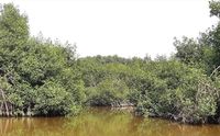
Les mangroves sont des écosystèmes précieux qui apportent à l'humanité des bénéfices socio-économiques, environnementaux et culturels essentiels. Cependant, elles connaissent un déclin alarmant en raison des activités humaines et des risques naturels. L'évaluation de leur dynamique spatio-temporelle est indispensable pour le suivi de ces écosystèmes et pour guider leur gestion afin d'en assurer la pérennité. Nous avons évalué la dynamique spatio-temporelle des mangroves et établi leurs tendances prévisionnelles en utilisant des techniques de télédétection et l'analyse en chaîne markovienne. Des images Landsat TM/ETM+ (pour 1988, 2001 et 2019) ont été obtenues, traitées, classées et analysées à l'aide de techniques de télédétection et de SIG. Les changements observés au cours de ces périodes (1988-2001, 2001-2019 et 1988-2019) ont été utilisés pour prévoir les tendances à l'horizon 2050, à l'aide de l'analyse en chaîne markovienne. Les résultats montrent que la zone de mangrove étudiée, qui occupait 5205,24 ha en 1988, a diminué de 62,07 % entre 1988 et 2001 mais a augmenté de 18,84 % de 2001 à 2019. Cette augmentation est attribuée au renforcement des efforts de restauration de la mangrove. Les mangroves ont été principalement converties en prairies (52,35 % en 1988-2001 et 7,31 % en 2001-2019) et en d'autres types de végétation (17,57 % en 1988-2001 et 27,05 % en 2001-2019). Leur déclin a été le plus important dans les communes d'Abomey-Calavi et de Ouidah, lesquelles nécessitent donc des efforts de conservation plus importants. Notre projection basée sur l'analyse en chaîne markovienne suggère que ces mangroves continueront à décliner, mais lentement. Cette étude fournit des informations essentielles pour guider les actions de conservation des mangroves à prévoir dans la zone d'étude.
Téléchargements
Références
Adam K. S., Boko M., 1993. Le Bénin. Cotonou, Bénin, Les Éditions du Flamboyant, 95 p.
Andrieu J., Lombard F., Fall A., Thior M., Ba B. D., Dieme B. E. A., 2020. Botanical field-study and remote sensing to describe mangrove resilience in the Saloum Delta (Senegal) after 30 years of degradation narrative. Forest Ecology and Management, 461: 117963.
Andrieu J., 2018. Land cover changes on the West-African coastline from the Saloum Delta (Senegal) to Rio Geba (Guinea-Bissau) between 1979 and 2015. European Journal of Remote Sensing, 51 (1): 314-325.
https://doi.org/10.1080/22797254.2018.1432295
Armah A. K., Diame A., Gordon A., Kairo J., 2010. Protection des mangroves : Le rôle du Réseau africain des mangroves. Nature et Faune, 24 (1) : 27-51.
Balla Dièye E. H., Tahirou Diaw A., Sané T., Ndour N., 2013. Dynamique de la mangrove de l’estuaire du Saloum (Sénégal) entre 1972 et 2010. Cybergeo. Revue Européenne de Géographie. https://doi.org/10.4000/cybergeo.25671
Barima Y. S. S., Barbier N., Bamba I., Traoré D., Lejoly J., Bogaert J., 2009. Dynamique paysagère en milieu de transition forêt-savane ivoirienne. Bois et Forêts des Tropiques, 299 (1) : 15-25. https://doi.org/10.19182/bft2009.299.a20419
Barima Y. S. S., Kouakou A. T. M., Bamba I., Sangne Y. C., Godron M., Andrieu J., et al., 2016. Cocoa crops are destroying the forest reserves of the classified forest of Haut-Sassandra (Ivory Coast). Global Ecology and Conservation, 8: 85-98. https://doi.org/10.1016/j.gecco.2016.08.009
Beger M., Grantham H. S., Pressey R. L., Wilson K. A., Peterson E. L., Dorfman D., et al., 2010. Conservation planning for connectivity across marine, freshwater, and terrestrial realms. Biological Conservation, 143: 565e575. https://doi.org/10.1016/j.biocon.2009.11.006
Bonn F., Rochon G., 1992. Précis de télédétection. Principes et méthodes. Presses de l’Université du Québec, Canada, vol. 1, 485 p.
Buelow C. A., Baker R., Reside A. E., Sheaves M., 2017. Spatial dynamics of coastal forest bird assemblages: the influence of landscape context, forest type, and structural connectivity. Landscape Ecology, 32 (3): 547-561. https://doi.org/10.1007/s10980-016-0461-z
Carr M. H., Robinson S. P., Wahle C., Davis G., Kroll S., Murray S., et al., 2017. The central importance of ecological spatial connectivity to effective coastal marine protected areas and to meeting the challenges of climate change in the marine environment. Aquatic Conservation Marine and Freshwater Ecosystems, 27: 6-29. https://doi.org/10.1002/aqc.2800
Chander G, Markham BL., 2003. Revised Landsat-5 TM radiometric calibration procedures, and post-calibration dynamic ranges. IEEE Trans. Geosci. Remote Sens.,41(11): 2674-2677. https://doi.org/10.1109/TGRS.2003.818464
Chang S. E., Adams B. J., Alder J., Berke P. R., Chuenpagdee R., Ghosh S., et al., 2006. Coastal ecosystems and tsunami protection after the December 2004 Indian Ocean tsunami. Earthquake Spectra, 22 (3_suppl): 863-887. https://doi.org/10.1193/1.2201971
Danielsen F., Sørensen M. K., Olwig M. F., Selvam V., Parish F., Burgess N. D., et al., 2005. The Asian tsunami: A protective role for coastal vegetation. Science, 310 (5748): 643. https://doi.org/10.1126/science.1118387
Das S., Angadi D. P., 2020. Assessment of urban sprawl using landscape metrics and Shannon’s entropy model approach in town level of Barrackpore sub-divisional region, India. Modeling Earth Systems and Environment, 7: 1071-1095. https://doi.org/10.1007/s40808-020-00990-9
Dimobe K., Wala K., Batawila K., Dourma M., Woegan Y. A., Akpagana K., 2012. Analyse spatiale des différentes formes de pressions anthropiques dans la réserve de faune de l’Oti-Mandouri (Togo). VertigO, Hors-série 14. https://doi.org/10.4000/vertigo.12423
Faye B., Dome T., Diop C., Ndiaye D., Ndiaye A., Faye G., 2018. Dynamique et détection des changements des unités d’occupation du Nord de l’estuaire du Saloum (Sénégal) de 1973 à 2014. Revue Marocaine de Géomorphologie, 2 : 79-96.
Folega, F., Rakotondrasoa, M.A., Wala, K., Woegan, Y.A., Kanda, M., Pereki, H., Polo-Akpisso, A., Batawila, K., Akpagana, K., 2017. Écologie et dynamique spatio-temporelle des mangroves au Togo. VertigO,17 (3):1-22. https://doi.org/10.4000/vertigo.18791
Foody G. M., 2002. Status of land cover classification accuracy assessment. Remote Sensing of Environment, 80: 185-201. https://doi.org/10.1016/S0034-4257(01)00295-4
Gevana D., Camacho L., Carandang A., Camacho S., Im S., 2015. Land use characterization and change detection of a small mangrove area in Banacon Island, Bohol, Philippines using a maximum likelihood classification method. Forest Science and Technology, 11 (4): 197-205. https://doi.org/10.1080/21580103.2014.996611
Gilman E. L., Ellison J., Duke N. C., Field C., 2008. Threats to mangroves from climate change and adaptation options: A review. Aquatic Botany, 89 (2): 237-250. https://doi.org/10.1016/j.aquabot.2007.12.009
Giri C., Long J., Abbas S., Murali R. M., Qamer F. M., Pengra B., et al., 2015. Distribution and dynamics of mangrove forests of South Asia. Journal of Environmental Management, 148: 101-111. https://doi.org/10.1016/j.jenvman.2014.01.020
Giri C., Ochieng E., Tieszen L. L., Zhu Z., Singh A., Loveland T., et al., 2011. Status and distribution of mangrove forests of the world using earth observation satellite data. Global Ecology and Biogeography, 20 (1): 154-159. https://doi.org/10.1111/j.1466-8238.2010.00584.x
Giri C., Zhu Z., Tieszen L. L., Singh A., Gillette S., Kelmelis J. A., 2008. Mangrove forest distributions and dynamics (1975-2005) of the tsunami-affected region of Asia. Journal of Biogeography, 35: 519-528. https://doi.org/10.1111/j.1365-2699.2007.01806.x
Godard. V., 2005. Typologie des paysages forestiers du sud du massif de Fontainebleau après la tempête de décembre 1999. Évaluation des dégâts forestiers à l’aide d’un semis de points et d’imagerie satellitale optique. Revue Internationale de Géomatique, 15 : 281-302.
Goldberg L., Lagomasino D., Thomas N., Fatoyinbo T., 2020. Global declines in human‐driven mangrove loss. Global Change Biology, 26 (10): 5844-5855. https://doi.org/10.1111/gcb.15275
Hogarth P. J., 1999. The biology of mangroves. Oxford, United Kingdom, Oxford University Press, 228 p.
INSAE, 2015. Quatrième Recensement général de la population et de l’habitation du Bénin. Cotonou, Bénin, INSAE. https://insae.bj/
INSAE, 2009. Tableau de bord économique et social. Quatrième trimestre. Cotonou, Bénin, INSAE. https://insae.bj/
IPCC, 2007. Climate Change 2007. The Physical Science Basis Summary for Policymakers. Contribution of Working Group I to the Fourth Assessment Report of the Intergovernmental Panel on Climate Change. Geneva, Switzerland, IPCC, 1007 p. https://www.ipcc.ch/report/ar4/wg1/
Islam M. M., Chowdhury R. M., Zaman A. M., Rahman M. S., Islam M. N., Rudra A. K., et al., 2020. Spatiotemporal mapping mangroves of Tengragiri wildlife sanctuary under Barguna district of Bangladesh using freely available satellite imagery. Modeling Earth Systems and Environment, 6: 917-927. https://doi.org/10.1007/s40808-020-00728-7
Kana C. E., Ngouanet C., Céleste A., Tchanga T., Bernardin R., Tafokou J., et al., 2019. Potentiel de l’imagerie multi-capteur dans le suivi des mangroves de l’estuaire du Wouri-Cameroun. OSFACO 2019, 13-15 mars 2019, Cotonou, Bénin, 19 p. https://hal.archives-ouvertes.fr/hal-02189420
Kathiresan K., 2002. Why are mangroves degrading? Current Science, 83: 1246-1249. https://www.jstor.org/stable/24106478
Leempoel K., Satyaranayana B., Bourgeois C., Zhang J., Chen M., Wang J., et al., 2013. Dynamics in mangroves assessed by high-resolution and multi-temporal satellite data: A case study in Zhanjiang Mangrove National Nature Reserve (ZMNNR), P. R. China. Biogeosciences, 10 (8): 5681-5689. https://doi.org/10.5194/bg-10-5681-2013
Lombard F., Andrieu J., Descroix L., 2020. La population d’Avicennia germinans du delta du Saloum est-elle relictuelle depuis la dernière période humide ? Bois et Forêts des Tropiques, 346 : 51-64. https://doi.org/10.19182/bft2020.346.a36296
Manandhar R., Odeh I. O., Ancev T., 2009. Improving the accuracy of land use and land cover classifcation of Landsat data using post classification enhancement. Remote Sensing, 1: 330-344. https://doi.org/10.3390/rs1030330
Massó S., Bourgeois C., Appeltans W., Vanhoorne B., Hauwere N. D., Stoffelen P., et al., 2010. The Mangrove Reference Database and Herbarium. Plant Ecology and Evolution, 143 (2): 225-232. https://doi.org/10.5091/plecevo.2010.439
Mayaux P., Gond V., Massart M., Pain-Orcet M., Achard F., 2003. Évolution du couvert forestier du bassin du Congo mesurée par télédétection spatiale. Bois et Forêts des Tropiques, 277 (3) : 45-52. https://revues.cirad.fr/index.php/BFT/article/view/20183
Munyemba K. F., Bogaert J., 2014. Anthropisation et dynamique spatiotemporelle de l’occupation du sol dans la région de Lubumbashi entre 1956 et 2009. E-revue Unilu, 1 : 3-23. http://www.unilu.ac.cd/pressesuniversitaires/wp-content/uploads/2015/05/Munyemba-et-Bogaert.pdf
N’Da D. H., N’Guessan K. E., Wadja E. M., Kouadio A., 2008. Apport de la télédétection au suivi de la déforestation dans le Parc National de la Marahoué (Côte d’Ivoire). Télédétection, 8(1) : 17 -34. https://halshs.archives-ouvertes.fr/halshs-00386032
Orekan O. A. V., Toffi D. M. A., Hohodji I. A., Plabeto H., 2018. Dynamique spatiale des écosystèmes de mangrove dans l’arrondissement d’Avlo-Grand-Popo sur le Littoral du Bénin. International Journal of Science Engineering Research, 9 (10) : 487-494.
Orekan V., Plagbeto H., Edea E., Sossou M., 2019. Évolution actuelle des écosystèmes de mangrove dans le littoral béninois. OSFACO 2019, 13-15 mars 2019, Cotonou, Bénin, 15 p. https://hal.archives-ouvertes.fr/hal-02189536
Oszwald J., 2005. Dynamique des formations agroforestières en Côte d’Ivoire (des années 1980 aux années 2000) suivi par télédétection et développement d’une approche cartographique. Thèse de Doctorat, UFR de Géographie et d’aménagement, Université des sciences et technologies de Lille (Lille, France), 304 p.
Padonou E. A., Lykke A. M., Bachmann Y., Idohou R., Sinsin B., 2017. Mapping changes in land use/land cover and prediction of future extension of bowé in Benin, West Africa. Land Use Policy, 69: 85-92. https://doi.org/10.1016/j.landusepol.2017.09.015
Polidoro B. A., Carpenter K. E., Collins L., Duke N. C., Ellison A. M., Ellison J. C., et al., 2010. The loss of species: Mangrove extinction risk and geographic areas of global concern. PLoS ONE, 5 (4): e10095. https://doi.org/10.1371/journal.pone.0010095
Puyravaud J.-P., 2003. Standardizing the calculation of the annual rate of deforestation. Forest Ecology and Management, 177 (1-3): 593-596. https://doi.org/10.1016/S0378-1127(02)00335-3
Roy S., Mahapatra M., Chakraborty A., 2019. Mapping and monitoring of mangrove along the Odisha coast based on remote sensing and GIS techniques. Modeling Earth Systems and Environment, 5 (1): 217-226. https://doi.org/10.1007/s40808-018-0529-7
Salazar-Ortiz E., 2017. Land Use and Land Management during the Past Century Determine Mangrove Dynamics in Northwestern Puerto Rico: The Case of the Maracayo Mangrove. Journal of Environmental Science and Engineering, 6: 593-623. https://doi.org/10.17265/2162-5263/2017.12.002
Sambieni K. R., Toyi M. S., Mama A., 2015. Perception paysanne sur la fragmentation du paysage de la Forêt classée de l’Ouémé Supérieur au nord du Bénin. VertigO, 15 (2). https://doi.org/10.4000/vertigo.16477
Sinsin B., Tenté B., Yo Tiemoko, Adanguidi J., Lougbénon T., Ahouansou S., et al., 2018. Inventaire floristique et faunique des écosystèmes de mangroves et des zones humides côtières du Bénin. FAO, Bénin, 89 p.
Sinzogan F., Adje A. H. C., Degbe C. G., Edea E., Dassi E., Orou M. A., et al., 2019. Rapport. Description des zones marine et côtière d’importance écologique ou biologique (ZIEB) au Sud-Bénin. Ministère du Cadre de Vie et du Développement durable, 64 p. https://mamiwataproject.org/wp-content/uploads/2019/08/Rapport-de-Description-des-ZIEB-du-Benin.pdf
Skupinski G., Binhtran D., Weber C., 2009. Les images satellites Spot multi-dates et la métrique spatiale dans l’étude du changement urbain et suburbain : le cas de la basse vallée de la Bruche (Bas-Rhin, France). Cybergeo. Revue Européenne de Géographie, 439. https://doi.org/10.4000/cybergeo.21995
Solly B., Sané T., Diaw A. T., 2018. Dynamique de la mangrove de Thiobon dans l’estuaire de la Casamance (Sénégal) entre 1972 et 2017. European Scientific Journal, 14 (33) : 118-133. https://doi.org/10.19044/esj.2018.v14n33p118
Teka O., Houessou L. G., Djossa B. A., Bachmann Y., Oumorou M., Sinsin B., 2018. Mangroves in Benin, West Africa: threats, uses and conservation opportunities. Environment, Development and Sustainability, 21: 1153-1169. https://doi.org/10.1007/s10668-017-0075-x
Wilkie M. L., Fortuna S., 2003. Status and Trends in Mangrove Area Extent Worldwide. FAO, Forest Resource Division, Working Paper no. 63. https://www.fao.org/3/j1533e/j1533e00.htm
Zanvo M. G. S., Salako K. V., Gnangle C., Mensah S., Assogbadjo A. E., Glèlè Kakaï R., 2021. Human disturbances have less effect on tree taxonomic diversity than structural diversity, population structure, and stability in a west-African mangrove forest. Wetlands Ecology and Management, 29: 433-450. https://doi.org/10.1007/s11273-021-09793-w
Téléchargements
Numéro
Rubrique
-
Résumé2699
-
PDF1424
Publié
Comment citer
Licence
© CIRAD - Bois et Forêts des Tropiques 2021

Ce travail est disponible sous la licence Creative Commons Attribution 4.0 International .
![]() Les articles sont publiés en Accès libre. Ils sont régis par le Droit d'auteur et par les licenses créative commons. La license utilisée est Attribution (CC BY 4.0).
Les articles sont publiés en Accès libre. Ils sont régis par le Droit d'auteur et par les licenses créative commons. La license utilisée est Attribution (CC BY 4.0).